Special weather statement issued for:
City of Toronto,
York – Durham,
Barrie – Orillia – Midland,
South River – Burk’s Falls,
Western Algonquin Park – Lake of Two Rivers,
Parry Sound – Muskoka,
Haliburton,
Fenelon Falls – Balsam Lake Park – Northern Kawartha Lakes,
Lindsay – Southern Kawartha Lakes,
City of Hamilton,
Bruce Peninsula – Sauble Beach – Tobermory,
Owen Sound – Blue Mountains – Northern Grey County,
Dufferin – Innisfil,
Halton – Peel,
Current details:
Strong winds expected with the passage of a cold front on Saturday.
Hazards:
South or southwest winds with gusts up to 70 km/h ahead of the cold front.
West or northwest winds with gusts up to 80 km/h along and behind the front.
Timing:
Early Saturday morning through the afternoon.
Impacts:
Utility outages may occur.
Damage to buildings, such as roof shingles and windows, may occur.
High winds may toss loose objects or cause tree branches to break.
Discussion:
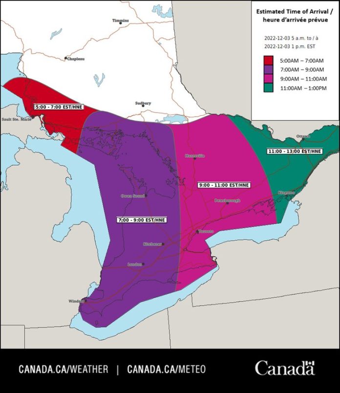
A north to south oriented cold front is expected to track east across the region on Saturday. Strong wind gusts of 70 to 80 km/h are possible with the passage of this front.
At this time, the cold front is expected to reach the Toronto area Saturday morning and the Ottawa area near noon on Saturday.
Please continue to monitor alerts and forecasts issued by Environment Canada. To report severe weather, send an email to ONstorm@ec.gc.ca or tweet reports using #ONStorm.


