


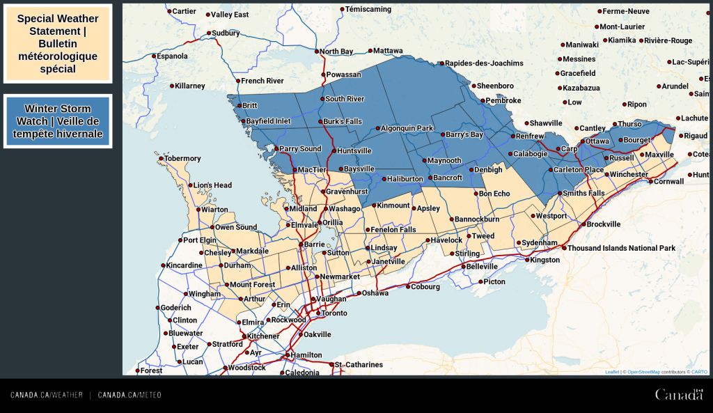
Special weather statement continued for:
Barrie – Orillia – Midland,
Port Carling – Port Severn,
Bracebridge – Gravenhurst,
Current details:
Significant snowfall with a risk of freezing rain possible Tuesday and Tuesday night.
Hazards:
10 to 15 cm of snow, with locally higher amounts possible.
Risk of freezing rain.
Hazardous travel conditions.
Timing:
Tuesday into Tuesday night.
Discussion:
Snow associated with a major winter storm is expected to move into portions of southern Ontario on Tuesday. Snow may be heavy at times with a risk of freezing rain. The snow is expected to change to rain Tuesday night as temperatures rise above the freezing mark.
Winter storm watch continued for:
South River – Burk’s Falls,
Western Algonquin Park – Lake of Two Rivers,
Huntsville – Baysville,
Town of Parry Sound – Rosseau – Killbear Park,
Haliburton,
Current details:
Impactful winter storm likely Tuesday afternoon into Wednesday.
Hazards:
15 to 25 cm of snow.
Risk of freezing rain and ice pellets.
Hazardous travel conditions.
Timing:
Tuesday afternoon through Wednesday morning.
Discussion:
Snow associated with a major winter storm is expected to arrive Tuesday afternoon and continue into Wednesday morning. There is a risk of ice pellets and freezing rain Tuesday night, with a complete changeover to rain possible for areas close to Georgian Bay.
The amount of snow will depend on how quickly precipitation changes to ice pellets, freezing rain or rain, although some locations may receive 15 to 25 cm of snow.
This is a heads up to the potential development of an impactful winter storm with heavy snow, ice pellets, and freezing rain. The exact track of this weather system is still somewhat uncertain, and as a result, expected snowfall amounts and precipitation types may change.
Warnings may be issued as this event draws nearer.