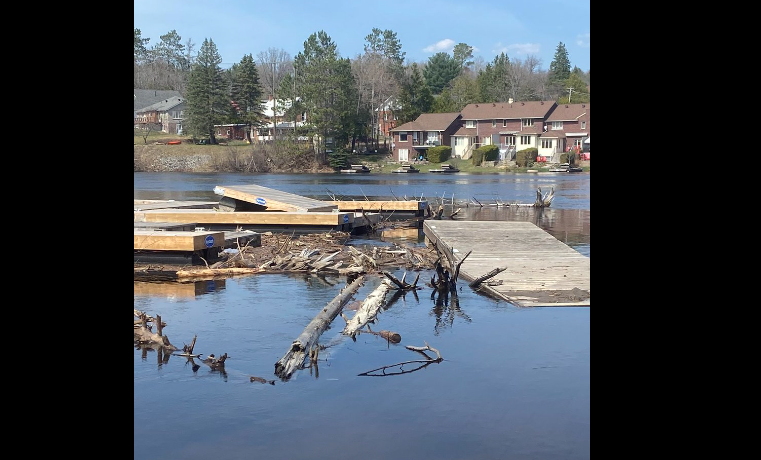
Huntsville received an average of 20 mm of rain overnight from April 16 to April 17. This precipitation has stalled the decrease in water levels in lakes north of Huntsville and the Big East River. These northern area water levels will continue to decline slowly, and levels are anticipated to recede in the Rivercove and Old North Road area.
Water levels downtown, in the Muskoka River and Mary Lake will continue to rise over the next few days as water makes its way through the watershed. Residents and businesses in these areas are encouraged to take precautions to protect property as flooding is occurring and is imminent in low lying areas.
The Town of Huntsville recommends being cautious if traveling on Huntsville waterways due to the large amounts of debris floating in the system. Boat traffic currently risks causing damage to shorelines and to shoreline property with vessel wakes because of the high water level.
Please refrain from trying to view flooding locations and supervise children and pets closely in these areas. Keep access to flooded areas open for emergency responders. Riverbanks and flowing water are unpredictable at this time.
Updates as of April 17, 2023:
- Sandbags: Free sandbags and fill station behind the Canada Summit Centre (20 Park Drive) and Port Sydney Fire Hall (387 S Mary Lake Rd). There are limited numbers of pre-filled bags currently available.
- Information on how to fill sand bags and how to build a sandbag dike can be found at Huntsville.ca
- Be aware of road closures and obey all posted signage.
- Visit Ontario.ca to learn more on what to do before, during and after a flood including the creation of a 72-hour kit.
- Residents are encouraged to check on family and friends in low lying areas prone to flooding to see if assistance is needed.
- For emergency text/SMS, email or voice calling updates in your area – Download and register the free Voyent Alert phone application.
The Town of Huntsville Emergency Control Group and Ministry of Natural Resources and Forestry (MNRF) Officials will continue to monitor conditions daily and provide updates and resources as required. The community is asked to follow Huntsville.ca for more information as conditions continue to evolve.
